

With the launch of the newly digitised Wellington Airport Development Collection we take a look back at a version of Rongotai that no longer exists.
Local resident Ron Cameron extensively documented the development of Wellington Airport and the effect it had on the shape of Rongotai, Evans Bay and Lyall Bay in the 1950s. A selection of his photographs are available to view in person at the Kilbirnie Library throughout the month of June.
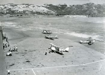
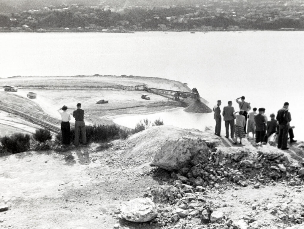
The original Rongotai Aerodrome opened in Lyall Bay in 1928, but as aircraft technology advanced, it was quickly noted that Wellington needed a bigger and more reliable airport. Proposals for a new site carried on for many years until the area that forms the airport today was formally selected in 1950. In order to achieve optimal runway length, the new runway would need to be extended into the sea on both sides of Rongotai. This would require extensive reclamation of both Evans and Lyall Bays, as well as the relocation of over 160 buildings.
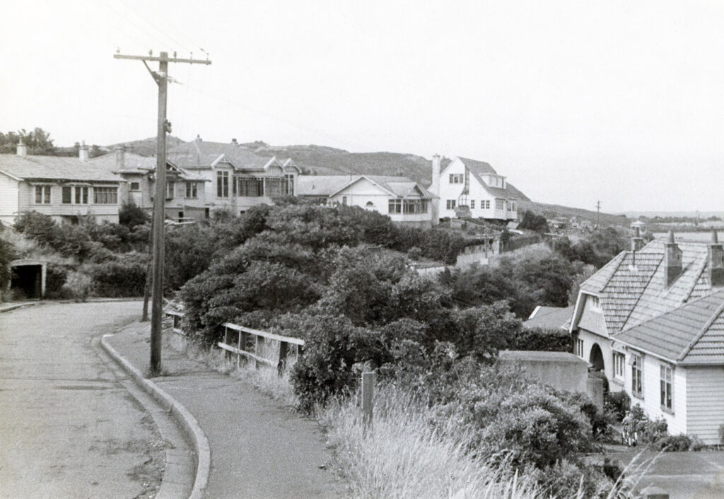
Construction couldn’t begin until the affected residents were relocated. Land for new homes in Wellington was already at a premium, so it was decided that the soil that had to be removed from nearby hills would be placed in Evans Bay, creating valuable reclaimed land for new residential zones. As earth from above Aberdeen Quay (now part of Cobham Drive) filled up more of the bay, houses in Rongotai were precariously relocated to their new sites in Kilbirnie.
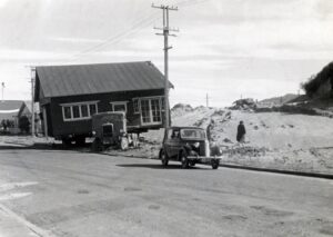
Not all buildings were eligible for relocation; any homes with extensive borer or brickwork were simply demolished. Ron Cameron’s own home on Wexford Street sat directly in the path of the new runway and was eventually torn down. His family, like many others, were moved into temporary housing in Kilbirnie.
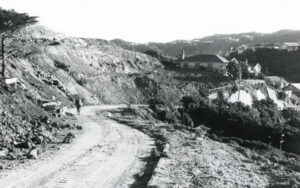
By 1956, all that was left of Rongotai Terrace was a bare hill. Watford Street was also completely erased, as well as sections of Wexford Road, Calabar Road, and Gaudin Street.
The ‘spoil’ was then slowly placed into Evans Bay using motor scrapers and a movable conveyor belt. Piece by piece over three million cubic metres of fill were excavated, transforming former parts of the Wellington coastline into usable land. Displaced residents from Rongotai were the first to be offered properties here, as well as in a new subdivision off Coromandel Street in Newtown that had been specially put aside for this purpose.
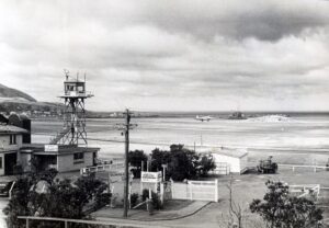
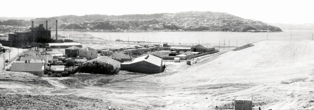
Once the hills were out of the way, gas and sewer lines were re-routed, new streets were formed, and the Coutts Street pedestrian subway was built. Seatoun Road (which previously ran along the Evans Bay shoreline) was widened and renamed Rongotai Road, and part of Aberdeen Quay was buried under the runway; the remining portion now forms part of Cobham Drive.
Wellington Airport’s runway still covers part of the original Aerodrome site. At its southern end, a large amount of Lyall Bay was reclaimed using soil from Moa Point. At its northern end, the concrete foundations of destroyed homes remain buried. Residential and industrial zones were shifted into Kilbirnie and a large portion of Evans Bay filled in.
Many of the original planned features never made it to the construction phase, such as a permanent base for flying boats which were briefly popular for domestic and international air travel in the early 1950s. However, a lot was also gained with the airport able to take larger international flights, marking Wellington as a key player in trans-Tasman aviation.
Wellington International Airport officially opened in October 1959 to much fanfare with an estimated 50,000 people attending on the day. It’s unknown whether Ron made it to the opening himself, given his albums do not feature any of his own photographs from the event. However, we are lucky enough to have around 350 of his printed photos, alongside original newspaper articles, that give us an insight to the challenges faced by both the community and the Airport itself during its development.
All three of Ron Cameron’s ‘Airport Development’ albums have been digitised in full and are available to view on our heritage platform Wellington City Recollect.